
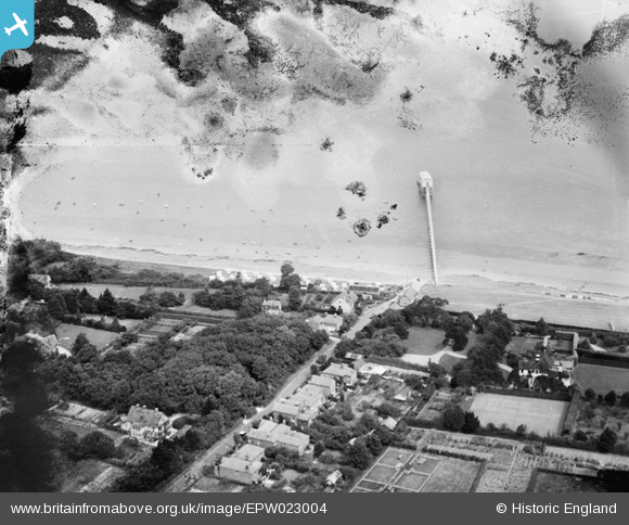
EPW023004 ENGLAND (1928). Lane End Road and the Lifeboat House at Ethel Point, Bembridge, from the south-west, 1928
© Copyright OpenStreetMap contributors and licensed by the OpenStreetMap Foundation. 2026. Cartography is licensed as CC BY-SA.
Details
| Title | [EPW023004] Lane End Road and the Lifeboat House at Ethel Point, Bembridge, from the south-west, 1928 |
| Reference | EPW023004 |
| Date | August-1928 |
| Link | |
| Place name | BEMBRIDGE |
| Parish | BEMBRIDGE |
| District | |
| Country | ENGLAND |
| Easting / Northing | 465551, 88043 |
| Longitude / Latitude | -1.0719378980359, 50.687764743981 |
| National Grid Reference | SZ656880 |
Pins
Be the first to add a comment to this image!