
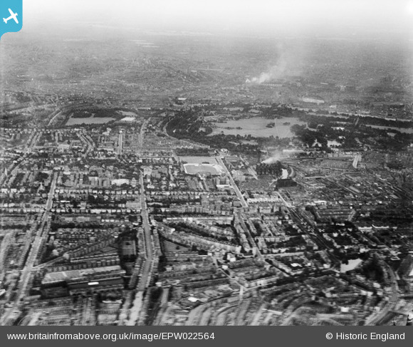
EPW022564 ENGLAND (1928). Lord's Cricket Ground and Regent's Park, St John's Wood, from the south-west, 1928
© Copyright OpenStreetMap contributors and licensed by the OpenStreetMap Foundation. 2026. Cartography is licensed as CC BY-SA.
Details
| Title | [EPW022564] Lord's Cricket Ground and Regent's Park, St John's Wood, from the south-west, 1928 |
| Reference | EPW022564 |
| Date | 7-August-1928 |
| Link | |
| Place name | ST JOHN'S WOOD |
| Parish | |
| District | |
| Country | ENGLAND |
| Easting / Northing | 526226, 182272 |
| Longitude / Latitude | -0.18028596860175, 51.524756315489 |
| National Grid Reference | TQ262823 |
Pins

janule.ok |
Thursday 4th of November 2021 03:35:28 PM | |

Class31 |
Monday 3rd of March 2014 11:48:33 AM | |

John Swain |
Monday 19th of August 2013 07:20:38 PM | |
|
John Swain |
Monday 19th of August 2013 07:20:01 PM | |
|
John Swain |
Monday 19th of August 2013 07:17:21 PM | |
|
John Swain |
Monday 19th of August 2013 07:16:31 PM | |
|
John Swain |
Monday 19th of August 2013 07:15:20 PM | |
|
John Swain |
Monday 19th of August 2013 07:14:28 PM | |
|
John Swain |
Monday 19th of August 2013 07:13:40 PM | |
|
Class31 |
Monday 24th of September 2012 02:08:15 PM | |
|
Class31 |
Monday 24th of September 2012 02:07:43 PM | |
|
Class31 |
Monday 24th of September 2012 02:06:46 PM |
