
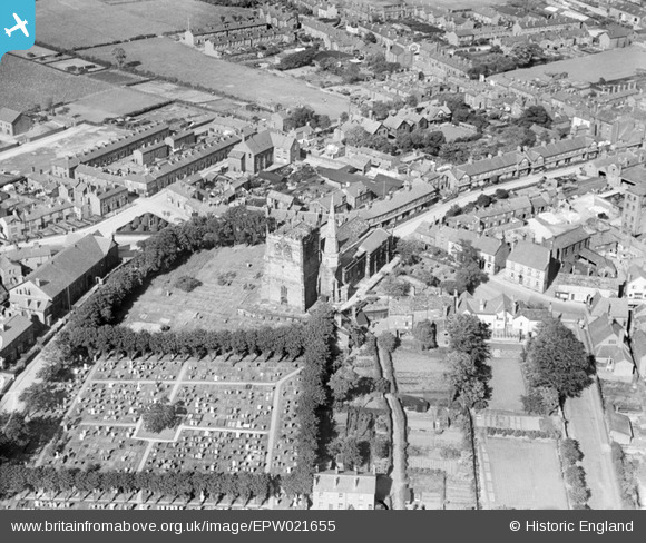
EPW021655 ENGLAND (1928). St Peter and St Paul's Church, Ormskirk, 1928
© Copyright OpenStreetMap contributors and licensed by the OpenStreetMap Foundation. 2025. Cartography is licensed as CC BY-SA.
Details
| Title | [EPW021655] St Peter and St Paul's Church, Ormskirk, 1928 |
| Reference | EPW021655 |
| Date | June-1928 |
| Link | |
| Place name | ORMSKIRK |
| Parish | |
| District | |
| Country | ENGLAND |
| Easting / Northing | 341289, 408429 |
| Longitude / Latitude | -2.8866360719285, 53.56893806533 |
| National Grid Reference | SD413084 |
Pins

Jim Martin |
Thursday 10th of May 2018 11:04:13 PM | |
|
Gary Simpson |
Wednesday 13th of February 2013 10:08:07 PM | |

Class31 |
Thursday 4th of October 2012 09:29:53 PM | |
|
Class31 |
Thursday 4th of October 2012 09:28:40 PM | |
|
Class31 |
Thursday 4th of October 2012 09:25:22 PM | |
|
Class31 |
Thursday 4th of October 2012 09:22:58 PM | |
|
Class31 |
Thursday 4th of October 2012 09:22:21 PM | |
|
Class31 |
Thursday 4th of October 2012 09:20:45 PM | |
|
Class31 |
Thursday 4th of October 2012 09:20:08 PM |
User Comment Contributions

Church of St Peter and St Paul, Ormskirk, 26/04/2016 |
Class31 |
Tuesday 3rd of May 2016 10:23:56 PM |