
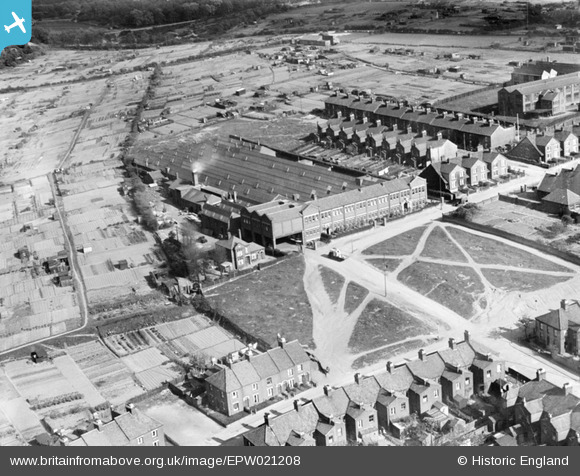
EPW021208 ENGLAND (1928). Boot Manufactory on Crome Road, Norwich, 1928
© Copyright OpenStreetMap contributors and licensed by the OpenStreetMap Foundation. 2026. Cartography is licensed as CC BY-SA.
Details
| Title | [EPW021208] Boot Manufactory on Crome Road, Norwich, 1928 |
| Reference | EPW021208 |
| Date | May-1928 |
| Link | |
| Place name | NORWICH |
| Parish | |
| District | |
| Country | ENGLAND |
| Easting / Northing | 623616, 310088 |
| Longitude / Latitude | 1.3055946618269, 52.642015454213 |
| National Grid Reference | TG236101 |
Pins

Chris Lambert |
Saturday 27th of August 2022 01:54:00 PM | |
|
Chris Lambert |
Saturday 25th of April 2015 08:31:09 PM | |
|
Chris Lambert |
Sunday 5th of April 2015 03:38:47 PM | |
|
Chris Lambert |
Sunday 5th of April 2015 03:35:20 PM | |
|
Chris Lambert |
Sunday 5th of April 2015 03:34:27 PM | |
|
vincey23 |
Tuesday 26th of June 2012 02:08:52 PM |