
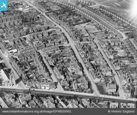
EPW020901 ENGLAND (1928). Wellington Street and environs, Long Eaton, 1928
© Copyright OpenStreetMap contributors and licensed by the OpenStreetMap Foundation. 2025. Cartography is licensed as CC BY-SA.
Details
| Title | [EPW020901] Wellington Street and environs, Long Eaton, 1928 |
| Reference | EPW020901 |
| Date | April-1928 |
| Link | |
| Place name | LONG EATON |
| Parish | |
| District | |
| Country | ENGLAND |
| Easting / Northing | 448511, 334138 |
| Longitude / Latitude | -1.2787005765163, 52.902168565979 |
| National Grid Reference | SK485341 |
Pins

John Wass |
Thursday 30th of September 2021 07:48:31 PM |