
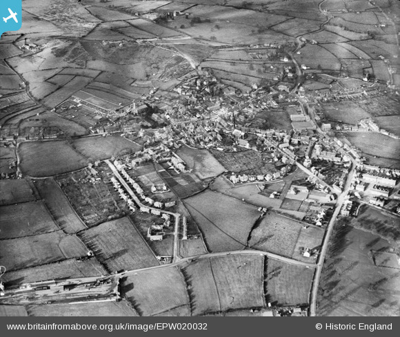
EPW020032 ENGLAND (1927). The town, Cheadle, 1927
© Copyright OpenStreetMap contributors and licensed by the OpenStreetMap Foundation. 2026. Cartography is licensed as CC BY-SA.
Details
| Title | [EPW020032] The town, Cheadle, 1927 |
| Reference | EPW020032 |
| Date | October-1927 |
| Link | |
| Place name | CHEADLE |
| Parish | CHEADLE |
| District | |
| Country | ENGLAND |
| Easting / Northing | 400762, 343068 |
| Longitude / Latitude | -1.9886485046356, 52.984641090665 |
| National Grid Reference | SK008431 |
Pins

bescotbeast |
Sunday 10th of December 2023 11:58:08 AM | |
|
bescotbeast |
Thursday 12th of September 2013 05:46:40 PM |
User Comment Contributions
Cheadle Staffordshire Moorlands |

Papalazaroo |
Monday 2nd of July 2012 04:09:41 PM |
Dear Papalazaroo, That’s great; as for EPW020031 thanks to your help we can update the catalogue. The revised record will appear here in due course. Katy Whitaker Britain from Above Cataloguer |
Katy Whitaker |
Monday 2nd of July 2012 04:09:41 PM |