
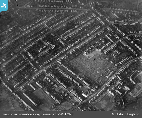
EPW017328 ENGLAND (1926). Douglas Road and environs, Tolworth, 1926
© Copyright OpenStreetMap contributors and licensed by the OpenStreetMap Foundation. 2025. Cartography is licensed as CC BY-SA.
Details
| Title | [EPW017328] Douglas Road and environs, Tolworth, 1926 |
| Reference | EPW017328 |
| Date | November-1926 |
| Link | |
| Place name | TOLWORTH |
| Parish | |
| District | |
| Country | ENGLAND |
| Easting / Northing | 518843, 166087 |
| Longitude / Latitude | -0.29210765991349, 51.380878642053 |
| National Grid Reference | TQ188661 |
Pins

edals |
Friday 9th of October 2020 11:11:08 AM | |
|
Pip |
Thursday 2nd of January 2014 03:21:37 PM | |
|
Pip |
Wednesday 1st of January 2014 12:46:59 PM | |
|
Pip |
Wednesday 1st of January 2014 12:45:56 PM | |
|
Pip |
Wednesday 1st of January 2014 12:42:47 PM | |
|
Pip |
Wednesday 1st of January 2014 12:42:00 PM | |
|
Pip |
Wednesday 1st of January 2014 12:40:42 PM | |
|
Pip |
Wednesday 1st of January 2014 12:40:07 PM | |
|
Pip |
Wednesday 1st of January 2014 12:39:29 PM | |
|
Pip |
Wednesday 1st of January 2014 12:38:38 PM | |
|
Pip |
Wednesday 1st of January 2014 12:38:11 PM | |
|
Pip |
Wednesday 1st of January 2014 12:37:41 PM | |
|
Pip |
Wednesday 1st of January 2014 12:37:03 PM | |
|
Pip |
Wednesday 1st of January 2014 12:12:34 PM | |
|
Pip |
Wednesday 1st of January 2014 12:12:01 PM | |
|
Pip |
Wednesday 1st of January 2014 12:11:41 PM | |
|
Pip |
Wednesday 1st of January 2014 12:11:03 PM | |
|
Pip |
Wednesday 1st of January 2014 12:10:26 PM | |
|
Pip |
Wednesday 1st of January 2014 12:07:31 PM | |
|
Pip |
Wednesday 1st of January 2014 12:06:52 PM | |
|
Pip |
Wednesday 1st of January 2014 12:05:49 PM | |
|
Pip |
Wednesday 1st of January 2014 12:05:16 PM | |
|
Pip |
Wednesday 1st of January 2014 12:04:36 PM |