
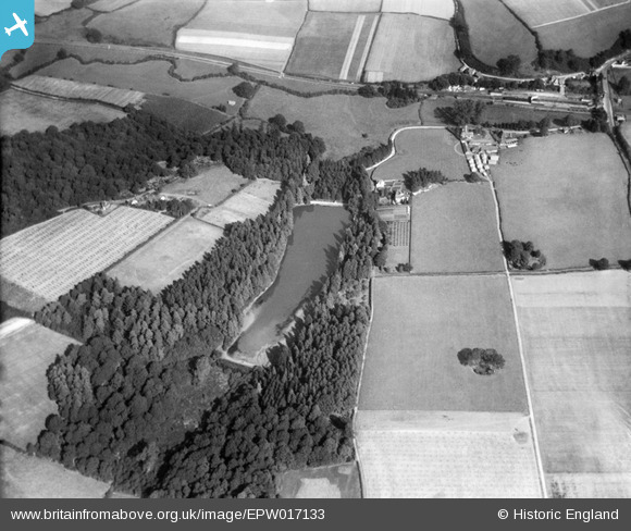
EPW017133 ENGLAND (1926). Hamsell Lake, Eridge Green, 1926
© Copyright OpenStreetMap contributors and licensed by the OpenStreetMap Foundation. 2026. Cartography is licensed as CC BY-SA.
Details
| Title | [EPW017133] Hamsell Lake, Eridge Green, 1926 |
| Reference | EPW017133 |
| Date | October-1926 |
| Link | |
| Place name | ERIDGE GREEN |
| Parish | ROTHERFIELD |
| District | |
| Country | ENGLAND |
| Easting / Northing | 553781, 134340 |
| Longitude / Latitude | 0.19600344117534, 51.087201461352 |
| National Grid Reference | TQ538343 |

