
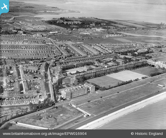
EPW016904 ENGLAND (1926). Eastney Barracks, Eastney, 1926
© Copyright OpenStreetMap contributors and licensed by the OpenStreetMap Foundation. 2026. Cartography is licensed as CC BY-SA.
Details
| Title | [EPW016904] Eastney Barracks, Eastney, 1926 |
| Reference | EPW016904 |
| Date | August-1926 |
| Link | |
| Place name | EASTNEY |
| Parish | |
| District | |
| Country | ENGLAND |
| Easting / Northing | 466669, 98939 |
| Longitude / Latitude | -1.0541400601052, 50.785619498305 |
| National Grid Reference | SZ667989 |
Pins

Terry |
Thursday 18th of June 2026 02:06:55 AM | |
|
Terry |
Thursday 18th of June 2026 02:06:11 AM | |
|
Terry |
Thursday 18th of June 2026 01:55:11 AM | |
|
Terry |
Thursday 18th of June 2026 01:42:53 AM | |
|
Terry |
Thursday 18th of June 2026 01:38:35 AM | |
|
Terry |
Thursday 18th of June 2026 01:36:02 AM | |
|
Terry |
Thursday 18th of June 2026 01:35:08 AM | |
|
5tumb1ebum |
Friday 25th of July 2014 10:31:53 PM | |
|
5tumb1ebum |
Friday 25th of July 2014 10:30:34 PM | |
|
Dan Gregory |
Monday 2nd of June 2014 06:39:27 PM |