
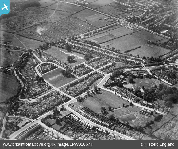
EPW016674 ENGLAND (1926). Crescent Way and environs, North Finchley, 1926
© Copyright OpenStreetMap contributors and licensed by the OpenStreetMap Foundation. 2026. Cartography is licensed as CC BY-SA.
Details
| Title | [EPW016674] Crescent Way and environs, North Finchley, 1926 |
| Reference | EPW016674 |
| Date | August-1926 |
| Link | |
| Place name | NORTH FINCHLEY |
| Parish | |
| District | |
| Country | ENGLAND |
| Easting / Northing | 526934, 191743 |
| Longitude / Latitude | -0.16666322091317, 51.609721096221 |
| National Grid Reference | TQ269917 |
Pins

richardperry |
Tuesday 20th of May 2025 10:28:51 AM | |
|
richardperry |
Tuesday 20th of May 2025 10:28:37 AM | |
|
richardperry |
Tuesday 20th of May 2025 10:27:56 AM | |
|
haggis |
Monday 14th of May 2018 03:22:30 PM | |
|
mr |
Friday 16th of December 2016 08:31:58 PM | |

melgibbs |
Thursday 24th of April 2014 07:52:21 PM | |
|
melgibbs |
Thursday 24th of April 2014 07:51:50 PM | |
|
melgibbs |
Thursday 24th of April 2014 07:51:20 PM | |

Finchleyflyer |
Thursday 28th of June 2012 12:17:14 PM |