
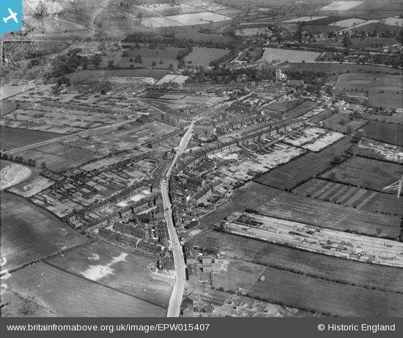
EPW015407 ENGLAND (1926). Snape Hill and the village, Darfield, 1926
© Copyright OpenStreetMap contributors and licensed by the OpenStreetMap Foundation. 2026. Cartography is licensed as CC BY-SA.
Details
| Title | [EPW015407] Snape Hill and the village, Darfield, 1926 |
| Reference | EPW015407 |
| Date | 3-May-1926 |
| Link | |
| Place name | DARFIELD |
| Parish | |
| District | |
| Country | ENGLAND |
| Easting / Northing | 441337, 404223 |
| Longitude / Latitude | -1.3762764105546, 53.532787776249 |
| National Grid Reference | SE413042 |
Pins
Be the first to add a comment to this image!