
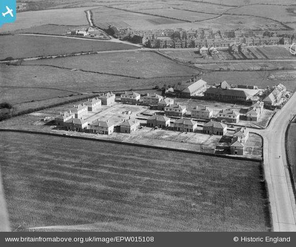
EPW015108 ENGLAND (1926). Housing and school buildings under construction at Burton Avenue, Rushall, 1926
© Copyright OpenStreetMap contributors and licensed by the OpenStreetMap Foundation. 2025. Cartography is licensed as CC BY-SA.
Details
| Title | [EPW015108] Housing and school buildings under construction at Burton Avenue, Rushall, 1926 |
| Reference | EPW015108 |
| Date | 12-May-1926 |
| Link | |
| Place name | RUSHALL |
| Parish | |
| District | |
| Country | ENGLAND |
| Easting / Northing | 402751, 301515 |
| Longitude / Latitude | -1.959368075994, 52.611051409221 |
| National Grid Reference | SK028015 |
Pins

KevTheBusDriver |
Sunday 2nd of February 2014 09:58:19 PM | |
|
KevTheBusDriver |
Sunday 2nd of February 2014 09:57:27 PM | |
|
KevTheBusDriver |
Sunday 2nd of February 2014 09:57:02 PM | |
|
JABE |
Saturday 6th of October 2012 08:35:32 AM |