
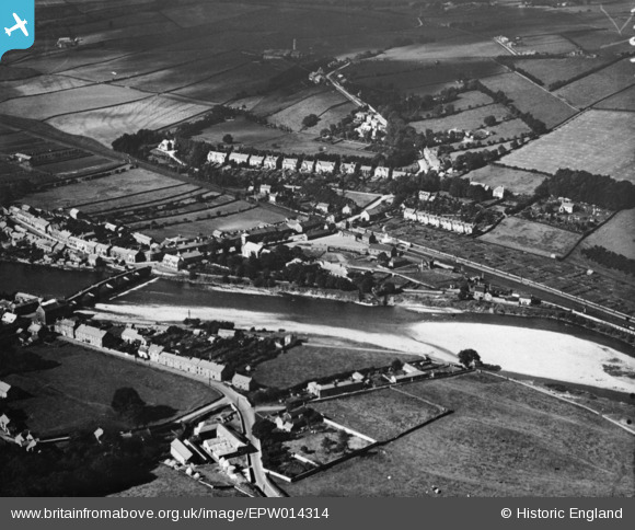
EPW014314 ENGLAND (1925). The village, Haydon Bridge, 1925. This image has been produced from a copy-negative.
© Copyright OpenStreetMap contributors and licensed by the OpenStreetMap Foundation. 2026. Cartography is licensed as CC BY-SA.
Details
| Title | [EPW014314] The village, Haydon Bridge, 1925. This image has been produced from a copy-negative. |
| Reference | EPW014314 |
| Date | 24-September-1925 |
| Link | |
| Place name | HAYDON BRIDGE |
| Parish | HAYDON |
| District | |
| Country | ENGLAND |
| Easting / Northing | 384294, 564480 |
| Longitude / Latitude | -2.2453960340588, 54.974609639882 |
| National Grid Reference | NY843645 |
Pins

Gregory |
Tuesday 2nd of December 2025 09:47:17 PM | |
|
PinzaC55 |
Thursday 14th of November 2024 10:49:05 PM | |
 |

Billy Turner |
Wednesday 18th of November 2015 07:51:31 PM |