
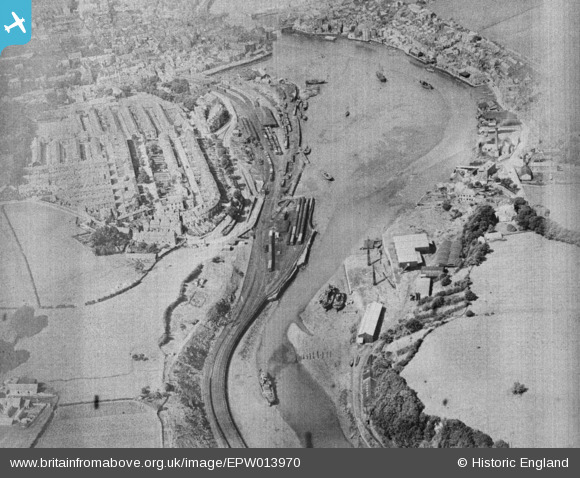
EPW013970 ENGLAND (1925). The Upper Harbour, Whitby, 1925. This image has been produced from a damaged copy-negative.
© Copyright OpenStreetMap contributors and licensed by the OpenStreetMap Foundation. 2026. Cartography is licensed as CC BY-SA.
Details
| Title | [EPW013970] The Upper Harbour, Whitby, 1925. This image has been produced from a damaged copy-negative. |
| Reference | EPW013970 |
| Date | 27-July-1925 |
| Link | |
| Place name | WHITBY |
| Parish | WHITBY |
| District | |
| Country | ENGLAND |
| Easting / Northing | 489914, 510356 |
| Longitude / Latitude | -0.6120984231383, 54.480444050771 |
| National Grid Reference | NZ899104 |
