
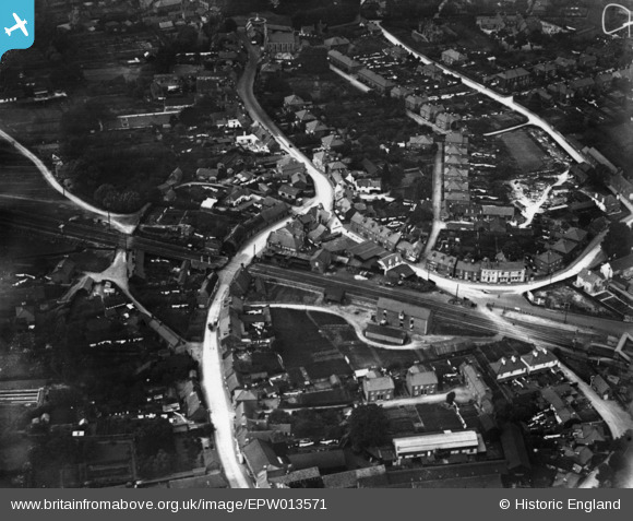
EPW013571 ENGLAND (1925). Christchurch Road and the railway line, Ringwood, 1925. This image has been produced from a print.
© Copyright OpenStreetMap contributors and licensed by the OpenStreetMap Foundation. 2026. Cartography is licensed as CC BY-SA.
Details
| Title | [EPW013571] Christchurch Road and the railway line, Ringwood, 1925. This image has been produced from a print. |
| Reference | EPW013571 |
| Date | June-1925 |
| Link | |
| Place name | RINGWOOD |
| Parish | RINGWOOD |
| District | |
| Country | ENGLAND |
| Easting / Northing | 415095, 104786 |
| Longitude / Latitude | -1.7855857415023, 50.841842583775 |
| National Grid Reference | SU151048 |
Pins

Bold Forester |
Tuesday 27th of August 2024 09:16:57 PM | |
|
Bold Forester |
Tuesday 27th of August 2024 09:16:25 PM | |
|
MikeMist |
Friday 6th of November 2020 08:59:22 PM | |
|
David960 |
Sunday 1st of February 2015 02:29:43 PM | |
|
David960 |
Saturday 31st of January 2015 07:12:50 PM | |
|
David960 |
Saturday 31st of January 2015 07:11:09 PM | |
|
David960 |
Saturday 31st of January 2015 07:08:08 PM |