
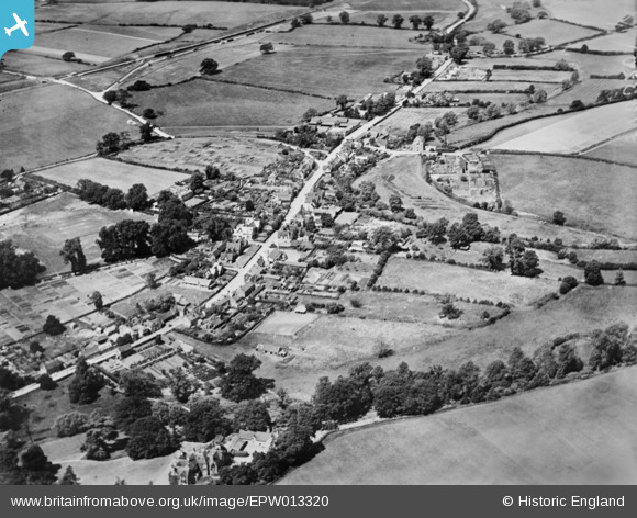
EPW013320 ENGLAND (1925). The village, Watton at Stone, 1925. This image has been produced from a copy-negative.
© Copyright OpenStreetMap contributors and licensed by the OpenStreetMap Foundation. 2026. Cartography is licensed as CC BY-SA.
Details
| Title | [EPW013320] The village, Watton at Stone, 1925. This image has been produced from a copy-negative. |
| Reference | EPW013320 |
| Date | June-1925 |
| Link | |
| Place name | WATTON AT STONE |
| Parish | WATTON-AT-STONE |
| District | |
| Country | ENGLAND |
| Easting / Northing | 530239, 219312 |
| Longitude / Latitude | -0.10863814801619, 51.856736291282 |
| National Grid Reference | TL302193 |
Pins

Lee_Again |
Friday 25th of August 2023 05:05:01 PM |