
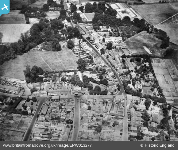
EPW013277 ENGLAND (1925). The High Street, St Mary Cray, 1925. This image has been produced from a copy-negative.
© Copyright OpenStreetMap contributors and licensed by the OpenStreetMap Foundation. 2026. Cartography is licensed as CC BY-SA.
Details
| Title | [EPW013277] The High Street, St Mary Cray, 1925. This image has been produced from a copy-negative. |
| Reference | EPW013277 |
| Date | June-1925 |
| Link | |
| Place name | ST MARY CRAY |
| Parish | |
| District | |
| Country | ENGLAND |
| Easting / Northing | 547114, 167424 |
| Longitude / Latitude | 0.11446005530206, 51.386270406278 |
| National Grid Reference | TQ471674 |
Pins

Barney |
Saturday 1st of November 2025 08:46:29 AM | |
|
Barney |
Saturday 1st of November 2025 08:45:44 AM | |
|
Barney |
Saturday 1st of November 2025 08:44:51 AM | |
|
Barney |
Saturday 1st of November 2025 08:43:56 AM | |
|
Barney |
Saturday 1st of November 2025 08:43:24 AM | |
|
Barney |
Saturday 1st of November 2025 08:42:17 AM | |
|
Barney |
Saturday 1st of November 2025 08:33:22 AM | |
|
Barney |
Saturday 1st of November 2025 08:32:31 AM | |
|
Barney |
Saturday 1st of November 2025 08:30:42 AM |