
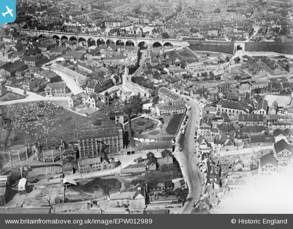
EPW012989 ENGLAND (1925). St Peter's Church and environs, Mansfield, 1925. This image has been produced from a copy-negative affected by flare.
© Copyright OpenStreetMap contributors and licensed by the OpenStreetMap Foundation. 2026. Cartography is licensed as CC BY-SA.
Details
| Title | [EPW012989] St Peter's Church and environs, Mansfield, 1925. This image has been produced from a copy-negative affected by flare. |
| Reference | EPW012989 |
| Date | June-1925 |
| Link | |
| Place name | MANSFIELD |
| Parish | |
| District | |
| Country | ENGLAND |
| Easting / Northing | 454115, 361001 |
| Longitude / Latitude | -1.1908786091015, 53.143112810065 |
| National Grid Reference | SK541610 |
Pins

NottmJas |
Saturday 3rd of February 2024 05:58:56 PM | |
|
NottmJas |
Saturday 3rd of February 2024 05:58:31 PM | |
|
WindyMiller |
Friday 13th of March 2020 09:29:40 PM | |
|
WindyMiller |
Friday 13th of March 2020 09:29:10 PM | |
|
John Wass |
Tuesday 10th of February 2015 08:36:39 PM | |
|
John Wass |
Tuesday 10th of February 2015 08:34:46 PM |