
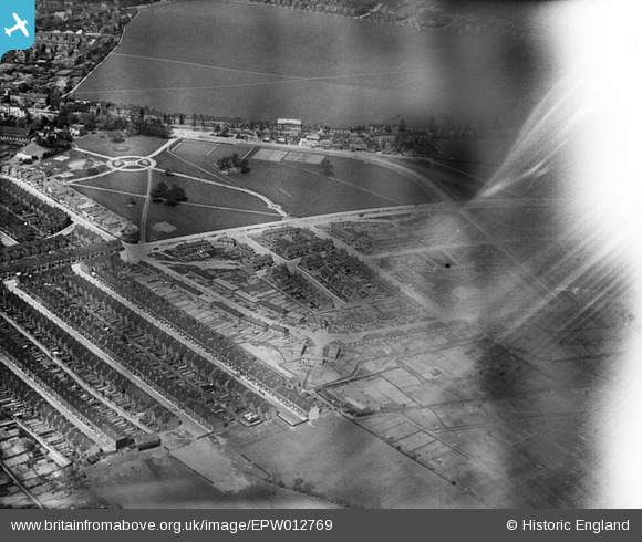
EPW012769 ENGLAND (1925). Elmfield Park, Doncaster, 1925
© Copyright OpenStreetMap contributors and licensed by the OpenStreetMap Foundation. 2026. Cartography is licensed as CC BY-SA.
Details
| Title | [EPW012769] Elmfield Park, Doncaster, 1925 |
| Reference | EPW012769 |
| Date | 15-May-1925 |
| Link | |
| Place name | DONCASTER |
| Parish | |
| District | |
| Country | ENGLAND |
| Easting / Northing | 458358, 402527 |
| Longitude / Latitude | -1.1197953717667, 53.515928302368 |
| National Grid Reference | SE584025 |
Pins

jonron |
Friday 9th of July 2021 02:55:19 AM | |

rossobantam |
Saturday 12th of October 2019 05:03:42 PM | |
|
rossobantam |
Saturday 12th of October 2019 05:03:01 PM |