
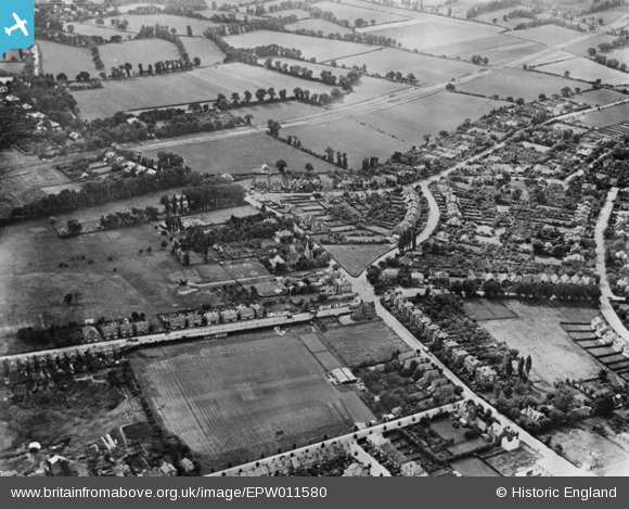
EPW011580 ENGLAND (1924). Housing surrounding Presburg Road and Malden Road opposite the Kingston By-Pass (A3) under construction, New Malden, 1924. This image has been produced from a copy-negative.
© Copyright OpenStreetMap contributors and licensed by the OpenStreetMap Foundation. 2026. Cartography is licensed as CC BY-SA.
Details
| Title | [EPW011580] Housing surrounding Presburg Road and Malden Road opposite the Kingston By-Pass (A3) under construction, New Malden, 1924. This image has been produced from a copy-negative. |
| Reference | EPW011580 |
| Date | July-1924 |
| Link | |
| Place name | NEW MALDEN |
| Parish | |
| District | |
| Country | ENGLAND |
| Easting / Northing | 521458, 167920 |
| Longitude / Latitude | -0.25391887891341, 51.39680094975 |
| National Grid Reference | TQ215679 |
Pins

Johnbg1948 |
Friday 16th of April 2021 08:26:43 PM | |
|
New Malden |
Thursday 2nd of February 2017 07:03:21 PM | |
|
New Malden |
Thursday 2nd of February 2017 07:01:27 PM | |
|
New Malden |
Thursday 2nd of February 2017 07:00:23 PM | |
|
New Malden |
Thursday 2nd of February 2017 06:59:27 PM | |
|
New Malden |
Thursday 2nd of February 2017 06:58:09 PM | |
|
New Malden |
Thursday 2nd of February 2017 06:56:09 PM | |
|
New Malden |
Thursday 2nd of February 2017 06:47:01 PM | |
|
New Malden |
Thursday 2nd of February 2017 03:17:56 PM |