
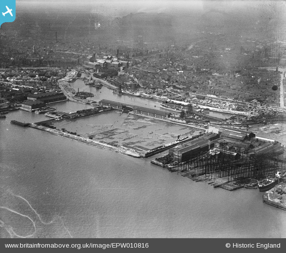
EPW010816 ENGLAND (1924). Victoria Dock, No. 1 Timber Pond and Earle's Shipbuilding and Engineering Yard, Kingston upon Hull, from the south-east, 1924
© Copyright OpenStreetMap contributors and licensed by the OpenStreetMap Foundation. 2026. Cartography is licensed as CC BY-SA.
Details
| Title | [EPW010816] Victoria Dock, No. 1 Timber Pond and Earle's Shipbuilding and Engineering Yard, Kingston upon Hull, from the south-east, 1924 |
| Reference | EPW010816 |
| Date | June-1924 |
| Link | |
| Place name | KINGSTON UPON HULL |
| Parish | |
| District | |
| Country | ENGLAND |
| Easting / Northing | 511428, 428367 |
| Longitude / Latitude | -0.31038657429755, 53.739540647231 |
| National Grid Reference | TA114284 |
Pins
Be the first to add a comment to this image!