
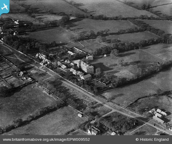
EPW009552 ENGLAND (1923). St Edward's School, Totteridge, 1923
© Copyright OpenStreetMap contributors and licensed by the OpenStreetMap Foundation. 2026. Cartography is licensed as CC BY-SA.
Details
| Title | [EPW009552] St Edward's School, Totteridge, 1923 |
| Reference | EPW009552 |
| Date | 1923 |
| Link | |
| Place name | TOTTERIDGE |
| Parish | |
| District | |
| Country | ENGLAND |
| Easting / Northing | 522873, 194025 |
| Longitude / Latitude | -0.22448584700742, 51.631132792259 |
| National Grid Reference | TQ229940 |
Pins

User Comment Contributions
St Edward's School, Totteridge, Barnet, from the southeast |

Tony D |
Monday 1st of July 2013 01:33:17 PM |
Hi Tony D, Thanks for spotting this one. The original Aerofilms Ltd Register entry simply says "Mill Street". We'll update the catalogue, and post the new data here in due course. Yours, Katy Britain from Above Cataloguing Team Leader |
Katy Whitaker |
Monday 1st of July 2013 01:33:17 PM |