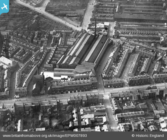
EPW007893 ENGLAND (1922). The Phoenix Safe Works and environs, Liverpool, 1922. This image has been produced from a print.
© Copyright OpenStreetMap contributors and licensed by the OpenStreetMap Foundation. 2026. Cartography is licensed as CC BY-SA.
Details
| Title | [EPW007893] The Phoenix Safe Works and environs, Liverpool, 1922. This image has been produced from a print. |
| Reference | EPW007893 |
| Date | May-1922 |
| Link | |
| Place name | LIVERPOOL |
| Parish | |
| District | |
| Country | ENGLAND |
| Easting / Northing | 336668, 389543 |
| Longitude / Latitude | -2.9526000066082, 53.398648683421 |
| National Grid Reference | SJ367895 |
Pins

John Tomlinson |
Thursday 22nd of January 2026 08:56:45 PM | |

andyohare |
Friday 28th of January 2022 09:46:39 PM | |

incony |
Wednesday 12th of February 2020 08:35:18 PM | |

Peter |
Wednesday 18th of April 2018 11:23:47 PM | |

Peter |
Wednesday 18th of April 2018 11:22:24 PM | |

Peter |
Tuesday 11th of October 2016 10:50:32 AM | |
https://localwiki.org/liverpool/Liverpool%27s_Historic_Rail_Tunnels#:~:text=Crown%20Street%20Stephenson%20Tunnel%20%2D%201829&text=Built%20by%20George%20Stephenson%2C%20a,state%20of%20the%20Cutting%20today. |

jimmyjoggers |
Saturday 1st of July 2023 07:28:30 PM |

Peter |
Tuesday 11th of October 2016 10:48:17 AM | |

Graeme |
Wednesday 26th of November 2014 07:40:05 AM | |

Graeme |
Wednesday 26th of November 2014 07:38:16 AM | |

Graeme |
Wednesday 26th of November 2014 07:37:47 AM | |

Graeme |
Wednesday 26th of November 2014 07:37:05 AM | |

Graeme |
Wednesday 26th of November 2014 07:36:19 AM | |

Graeme |
Wednesday 26th of November 2014 07:26:43 AM | |

Graeme |
Wednesday 26th of November 2014 07:25:36 AM | |

Graeme |
Wednesday 26th of November 2014 07:24:51 AM | |

Graeme |
Wednesday 26th of November 2014 07:24:11 AM | |

Graeme |
Wednesday 26th of November 2014 07:23:01 AM | |

Graeme |
Wednesday 26th of November 2014 07:22:03 AM | |

jamspy |
Wednesday 12th of November 2014 08:40:14 PM | |
St Nathaniel's Church, Dinorben St. |

Graeme |
Wednesday 26th of November 2014 07:35:54 AM |

Lanser |
Saturday 1st of November 2014 07:57:20 PM | |

Lanser |
Saturday 1st of November 2014 07:56:35 PM |
User Comment Contributions

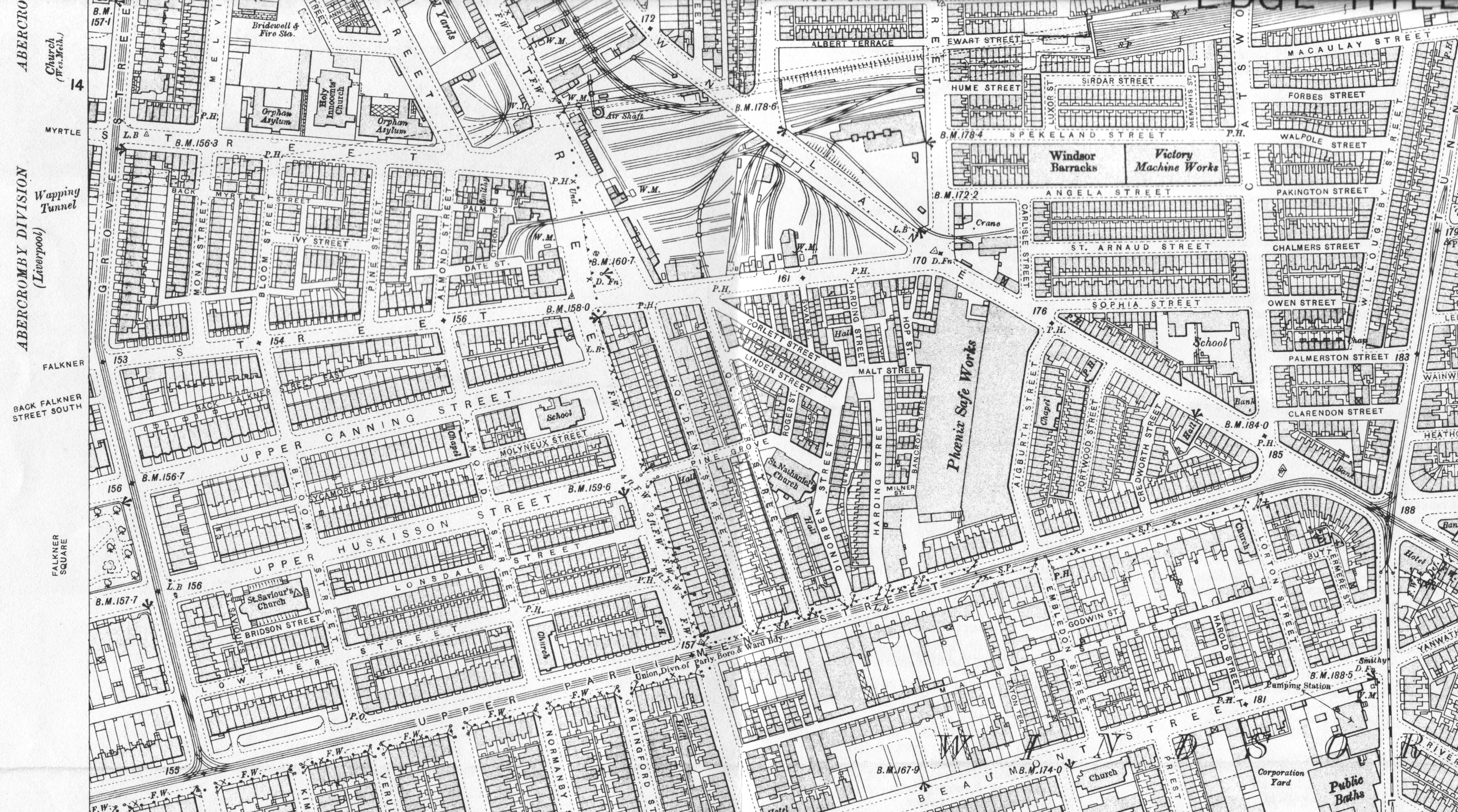
This photo is in the Edge Hill/Windsor area of Liverpool looking approx. North. I have attached a 1905 OS Map of the area. |

Graeme |
Wednesday 26th of November 2014 07:45:46 AM |

