
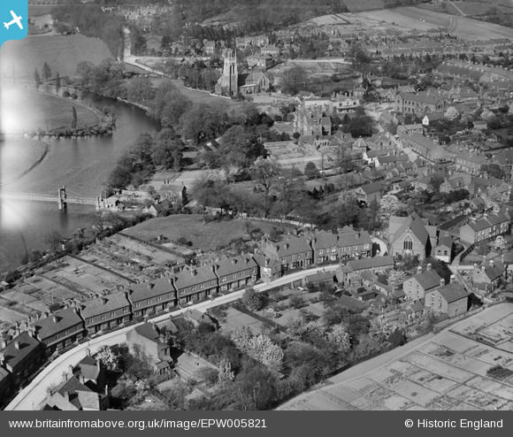
EPW005821 ENGLAND (1921). Ferry Street and St Peter's Church, Stapenhill, 1921
© Copyright OpenStreetMap contributors and licensed by the OpenStreetMap Foundation. 2025. Cartography is licensed as CC BY-SA.
Details
| Title | [EPW005821] Ferry Street and St Peter's Church, Stapenhill, 1921 |
| Reference | EPW005821 |
| Date | March-1921 |
| Link | |
| Place name | STAPENHILL |
| Parish | STAPENHILL |
| District | |
| Country | ENGLAND |
| Easting / Northing | 425395, 321876 |
| Longitude / Latitude | -1.6233507645825, 52.793519684736 |
| National Grid Reference | SK254219 |
Pins
Be the first to add a comment to this image!