
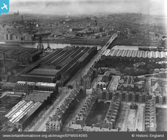
EPW004065 ENGLAND (1920). The Naval Construction Works, Barrow-in-Furness, 1920
© Copyright OpenStreetMap contributors and licensed by the OpenStreetMap Foundation. 2026. Cartography is licensed as CC BY-SA.
Details
| Title | [EPW004065] The Naval Construction Works, Barrow-in-Furness, 1920 |
| Reference | EPW004065 |
| Date | July-1920 |
| Link | |
| Place name | BARROW ISLAND |
| Parish | |
| District | |
| Country | ENGLAND |
| Easting / Northing | 319602, 468410 |
| Longitude / Latitude | -3.2297703536451, 54.105106725446 |
| National Grid Reference | SD196684 |
Pins

MB |
Wednesday 21st of September 2016 01:22:34 PM | |
|
Jan Cooper |
Tuesday 23rd of September 2014 06:41:21 PM | |
|
steve |
Saturday 10th of November 2012 08:56:41 PM |