
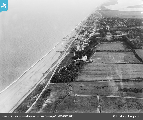
EPW001911 ENGLAND (1920). General view of the town, Aldeburgh, 1920
© Copyright OpenStreetMap contributors and licensed by the OpenStreetMap Foundation. 2026. Cartography is licensed as CC BY-SA.
Details
| Title | [EPW001911] General view of the town, Aldeburgh, 1920 |
| Reference | EPW001911 |
| Date | June-1920 |
| Link | |
| Place name | ALDEBURGH |
| Parish | ALDEBURGH |
| District | |
| Country | ENGLAND |
| Easting / Northing | 646568, 257148 |
| Longitude / Latitude | 1.6051987152962, 52.157036580742 |
| National Grid Reference | TM466571 |
Pins

Steve Tant |
Monday 22nd of November 2021 10:06:27 AM | |
|
Sally |
Wednesday 9th of April 2014 05:56:55 AM | |

Peter W |
Thursday 21st of March 2013 11:14:30 PM |