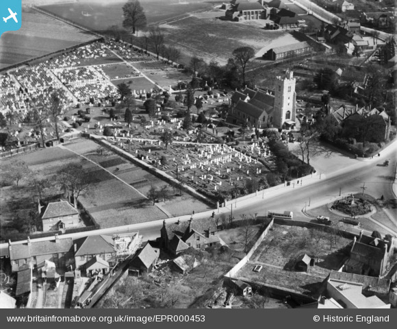
EPR000453 ENGLAND (1935). St Leonard's Church and churchyard, Heston, 1935
© Copyright OpenStreetMap contributors and licensed by the OpenStreetMap Foundation. 2024. Cartography is licensed as CC BY-SA.
Details
| Title | [EPR000453] St Leonard's Church and churchyard, Heston, 1935 |
| Reference | EPR000453 |
| Date | 21-March-1935 |
| Link | |
| Place name | HESTON |
| Parish | |
| District | |
| Country | ENGLAND |
| Easting / Northing | 513112, 177544 |
| Longitude / Latitude | -0.37077117925201, 51.485036563945 |
| National Grid Reference | TQ131775 |
Pins
 paul |
Tuesday 7th of February 2023 12:35:29 PM |


![[EPR000453] St Leonard's Church and churchyard, Heston, 1935](http://britainfromabove.org.uk/sites/all/libraries/aerofilms-images/public/100x100/EPR/000/EPR000453.jpg)
![[EPW056163] Heston Infants, Junior and Senior Schools off Heston Road, Heston, 1937. This image has been produced from a copy-negative.](http://britainfromabove.org.uk/sites/all/libraries/aerofilms-images/public/100x100/EPW/056/EPW056163.jpg)