
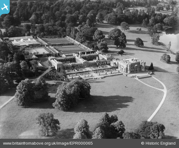
EPR000065 ENGLAND (1934). Bowood House, Derry Hill, 1934
© Copyright OpenStreetMap contributors and licensed by the OpenStreetMap Foundation. 2026. Cartography is licensed as CC BY-SA.
Details
| Title | [EPR000065] Bowood House, Derry Hill, 1934 |
| Reference | EPR000065 |
| Date | 2-July-1934 |
| Link | |
| Place name | DERRY HILL |
| Parish | CALNE WITHOUT |
| District | |
| Country | ENGLAND |
| Easting / Northing | 397488, 169916 |
| Longitude / Latitude | -2.0361356905174, 51.42775256516 |
| National Grid Reference | ST975699 |
Pins

MB |
Wednesday 7th of September 2016 08:07:00 PM |
User Comment Contributions
Wikipedia entry: https://en.wikipedia.org/wiki/Bowood_House |
MB |
Sunday 18th of September 2016 08:16:47 PM |