
Scheduled Maintenance
This website will undergo scheduled maintenance on Tuesday, September 10th, between 11:00 and 15:00, as well as on Thursday, September 12th, between 10:00 and 12:00. During this time, services may be temporarily disrupted. We apologise for any inconvenience.
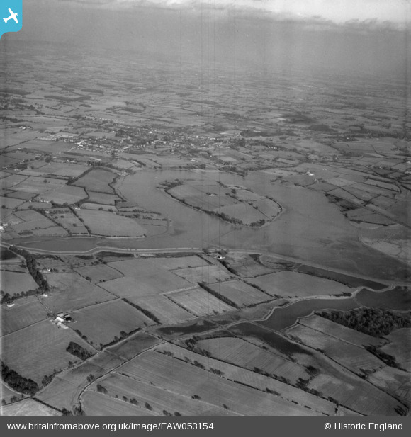
EAW053154 ENGLAND (1954). The River Adur in flood near Rye Farm, Henfield, from the south-west, 1954
© Copyright OpenStreetMap contributors and licensed by the OpenStreetMap Foundation. 2024. Cartography is licensed as CC BY-SA.
Details
| Title | [EAW053154] The River Adur in flood near Rye Farm, Henfield, from the south-west, 1954 |
| Reference | EAW053154 |
| Date | 20-February-1954 |
| Link | |
| Place name | HENFIELD |
| Parish | HENFIELD |
| District | |
| Country | ENGLAND |
| Easting / Northing | 519466, 114724 |
| Longitude / Latitude | -0.30020984561247, 50.919043532841 |
| National Grid Reference | TQ195147 |
Pins
 Biggles1951 |
Friday 14th of November 2014 05:40:29 PM | |
Biggles1951 |
Friday 14th of November 2014 05:38:37 PM | |
Biggles1951 |
Friday 14th of November 2014 05:36:07 PM |