
Downtime message
Due to planned maintenance taking place on Thursday 9th October between 9:00 AM and 1:00 PM, services might be disrupted or temporarily unavailable. We apologise for any inconvenience.
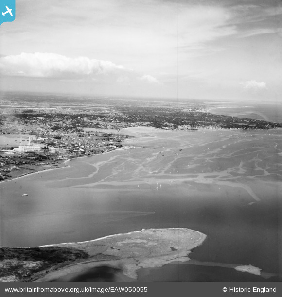
EAW050055 ENGLAND (1953). Poole Harbour and the town, Poole, from the west, 1953
© Copyright OpenStreetMap contributors and licensed by the OpenStreetMap Foundation. 2025. Cartography is licensed as CC BY-SA.
Details
| Title | [EAW050055] Poole Harbour and the town, Poole, from the west, 1953 |
| Reference | EAW050055 |
| Date | 18-June-1953 |
| Link | |
| Place name | POOLE |
| Parish | |
| District | |
| Country | ENGLAND |
| Easting / Northing | 399380, 89482 |
| Longitude / Latitude | -2.0087809055947, 50.70440075436 |
| National Grid Reference | SY994895 |
Pins

redmist |
Monday 25th of March 2024 08:46:57 PM |