
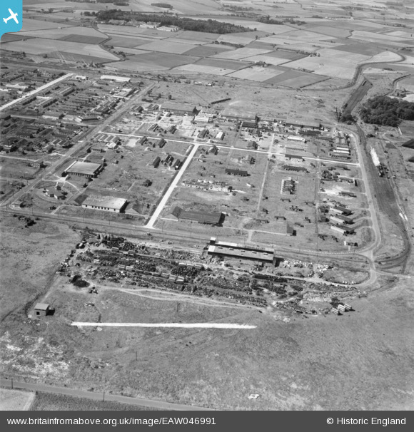
EAW046991 ENGLAND (1952). The Kirkby Industrial Estate around Bradman Road, Kirkby, 1952. This image was marked by Aerofilms Ltd for photo editing.
© Copyright OpenStreetMap contributors and licensed by the OpenStreetMap Foundation. 2026. Cartography is licensed as CC BY-SA.
Details
| Title | [EAW046991] The Kirkby Industrial Estate around Bradman Road, Kirkby, 1952. This image was marked by Aerofilms Ltd for photo editing. |
| Reference | EAW046991 |
| Date | 7-September-1952 |
| Link | |
| Place name | KIRKBY |
| Parish | |
| District | |
| Country | ENGLAND |
| Easting / Northing | 343718, 399260 |
| Longitude / Latitude | -2.8483100346962, 53.486789364117 |
| National Grid Reference | SJ437993 |
Pins
 PILLBOX: e90677 PILLBOX: e90677 |

Matt Aldred edob.mattaldred.com |
Saturday 24th of October 2026 05:38:42 PM |
| PILLBOX: e43140 |
Matt Aldred edob.mattaldred.com |
Friday 17th of July 2026 09:37:35 PM |
| PILLBOX: e43138 |
Matt Aldred edob.mattaldred.com |
Friday 17th of July 2026 09:37:06 PM |
| bus yard |

austin |
Friday 5th of June 2020 08:27:33 PM |
| shelters |
austin |
Sunday 29th of March 2020 12:11:08 PM |
| Water tower |
trotter |
Saturday 18th of January 2020 09:47:12 PM |