
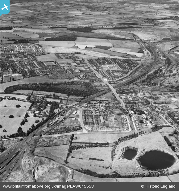
EAW045558 ENGLAND (1952). Corby Station, Rockingham Road and the town, Corby, from the south, 1952
© Copyright OpenStreetMap contributors and licensed by the OpenStreetMap Foundation. 2026. Cartography is licensed as CC BY-SA.
Details
| Title | [EAW045558] Corby Station, Rockingham Road and the town, Corby, from the south, 1952 |
| Reference | EAW045558 |
| Date | 19-July-1952 |
| Link | |
| Place name | CORBY |
| Parish | |
| District | |
| Country | ENGLAND |
| Easting / Northing | 489349, 288615 |
| Longitude / Latitude | -0.68398988195396, 52.487757136091 |
| National Grid Reference | SP893886 |
Pins

Michael Mahon |
Monday 12th of October 2015 06:24:44 PM |