
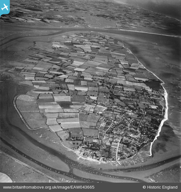
EAW043665 ENGLAND (1952). West Mersea and the Island, Mersea Island, from the west, 1952
© Copyright OpenStreetMap contributors and licensed by the OpenStreetMap Foundation. 2026. Cartography is licensed as CC BY-SA.
Details
| Title | [EAW043665] West Mersea and the Island, Mersea Island, from the west, 1952 |
| Reference | EAW043665 |
| Date | 4-June-1952 |
| Link | |
| Place name | MERSEA ISLAND |
| Parish | WEST MERSEA |
| District | |
| Country | ENGLAND |
| Easting / Northing | 600733, 213189 |
| Longitude / Latitude | 0.910367579022, 51.780852508721 |
| National Grid Reference | TM007132 |
Pins

Stephen Mirrington |
Monday 22nd of September 2025 09:26:32 AM | |
|
Stephen Mirrington |
Monday 22nd of September 2025 09:24:52 AM | |
|
redmist |
Monday 29th of January 2024 07:25:40 PM | |
|
redmist |
Monday 29th of January 2024 07:24:17 PM |