
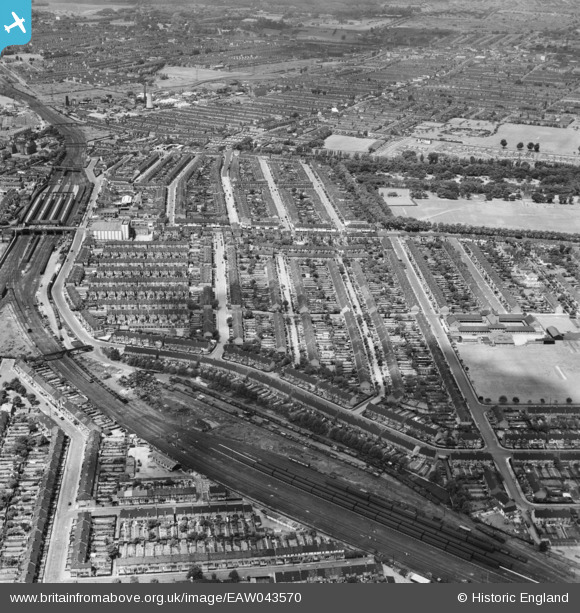
EAW043570 ENGLAND (1952). Residential streets between Barking Railway Station and Barking Park, Barking, from the south-east, 1952
© Copyright OpenStreetMap contributors and licensed by the OpenStreetMap Foundation. 2026. Cartography is licensed as CC BY-SA.
Details
| Title | [EAW043570] Residential streets between Barking Railway Station and Barking Park, Barking, from the south-east, 1952 |
| Reference | EAW043570 |
| Date | 4-June-1952 |
| Link | |
| Place name | BARKING |
| Parish | |
| District | |
| Country | ENGLAND |
| Easting / Northing | 544915, 184242 |
| Longitude / Latitude | 0.089771046962848, 51.537972853087 |
| National Grid Reference | TQ449842 |
Pins

pl8man |
Friday 13th of November 2020 11:56:00 AM | |
|
pl8man |
Friday 13th of November 2020 11:55:14 AM | |
|
pl8man |
Friday 13th of November 2020 11:53:51 AM | |
|
pl8man |
Friday 13th of November 2020 11:53:14 AM | |
|
pl8man |
Friday 13th of November 2020 11:51:59 AM | |
|
pl8man |
Friday 13th of November 2020 11:50:45 AM | |
|
pl8man |
Friday 13th of November 2020 11:50:03 AM | |
|
pl8man |
Friday 13th of November 2020 11:49:22 AM | |
|
Terry the Carpet Estimator |
Sunday 29th of May 2016 06:52:29 PM | |
|
Terry the Carpet Estimator |
Sunday 29th of May 2016 06:44:41 PM | |
|
Terry the Carpet Estimator |
Sunday 29th of May 2016 06:36:53 PM | |
|
Terry the Carpet Estimator |
Sunday 29th of May 2016 06:34:44 PM | |
|
John Wass |
Tuesday 23rd of June 2015 10:01:38 PM | |
probably the District Line to Upminster. |
Terry the Carpet Estimator |
Sunday 29th of May 2016 06:42:06 PM |