
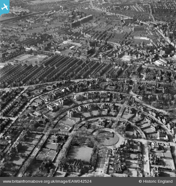
EAW042524 ENGLAND (1952). The residential areas at The Park and Radford, Nottingham, 1952
© Copyright OpenStreetMap contributors and licensed by the OpenStreetMap Foundation. 2026. Cartography is licensed as CC BY-SA.
Details
| Title | [EAW042524] The residential areas at The Park and Radford, Nottingham, 1952 |
| Reference | EAW042524 |
| Date | 17-April-1952 |
| Link | |
| Place name | NOTTINGHAM |
| Parish | |
| District | |
| Country | ENGLAND |
| Easting / Northing | 456004, 339889 |
| Longitude / Latitude | -1.166308105606, 52.953137843084 |
| National Grid Reference | SK560399 |
Pins

ih |
Monday 16th of October 2023 10:11:10 PM | |
|
ih |
Thursday 31st of August 2023 09:26:16 PM | |
|
ih |
Tuesday 2nd of November 2021 10:16:29 PM | |
|
ih |
Tuesday 2nd of November 2021 07:18:49 PM | |
|
ih |
Tuesday 2nd of November 2021 07:17:48 PM | |
|
KC |
Monday 31st of May 2021 11:05:32 AM | |
|
KC |
Monday 31st of May 2021 11:05:15 AM | |
|
KC |
Thursday 18th of March 2021 12:29:46 PM | |
|
KC |
Thursday 18th of March 2021 12:29:17 PM | |
|
KC |
Sunday 26th of July 2020 10:33:04 AM | |
|
martynrb |
Thursday 29th of November 2018 10:54:44 AM | |
|
martynrb |
Thursday 29th of November 2018 10:42:58 AM |