
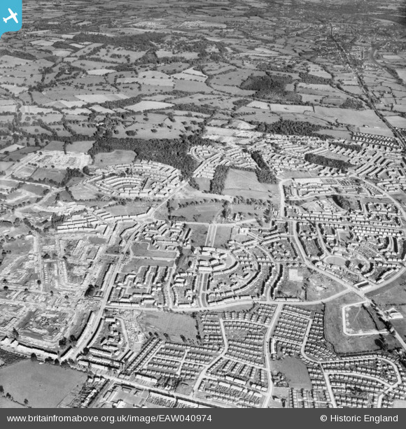
EAW040974 ENGLAND (1951). Construction of the Harold Hill Estate, Harold Hill, 1951
© Copyright OpenStreetMap contributors and licensed by the OpenStreetMap Foundation. 2026. Cartography is licensed as CC BY-SA.
Details
| Title | [EAW040974] Construction of the Harold Hill Estate, Harold Hill, 1951 |
| Reference | EAW040974 |
| Date | 23-October-1951 |
| Link | |
| Place name | HAROLD HILL |
| Parish | |
| District | |
| Country | ENGLAND |
| Easting / Northing | 554317, 192180 |
| Longitude / Latitude | 0.22873447530249, 51.606808288045 |
| National Grid Reference | TQ543922 |
Pins

jonnyace |
Saturday 30th of August 2025 11:47:12 PM | |
|
jonnyace |
Saturday 30th of August 2025 11:43:56 PM | |
|
jonnyace |
Saturday 30th of August 2025 11:43:14 PM | |
|
jonnyace |
Saturday 30th of August 2025 11:42:13 PM | |
|
jonnyace |
Saturday 30th of August 2025 11:41:28 PM | |
|
jonnyace |
Saturday 30th of August 2025 11:40:10 PM | |
|
jonnyace |
Saturday 30th of August 2025 11:38:20 PM | |
|
jonnyace |
Saturday 30th of August 2025 11:37:43 PM | |
|
Keni010 |
Wednesday 13th of April 2016 08:26:48 PM | |
|
Keni010 |
Wednesday 13th of April 2016 08:25:41 PM |