
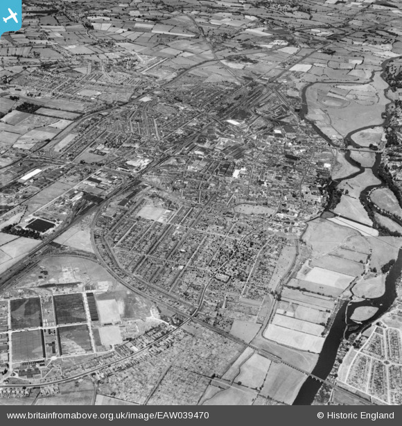
EAW039470 ENGLAND (1951). Birmingham Curve Junction and the town, Burton upon Trent, from the south, 1951
© Copyright OpenStreetMap contributors and licensed by the OpenStreetMap Foundation. 2026. Cartography is licensed as CC BY-SA.
Details
| Title | [EAW039470] Birmingham Curve Junction and the town, Burton upon Trent, from the south, 1951 |
| Reference | EAW039470 |
| Date | 3-September-1951 |
| Link | |
| Place name | BURTON UPON TRENT |
| Parish | ANGLESEY |
| District | |
| Country | ENGLAND |
| Easting / Northing | 424055, 321544 |
| Longitude / Latitude | -1.6432491353102, 52.790596297957 |
| National Grid Reference | SK241215 |
Pins

Helen |
Friday 25th of July 2025 05:02:04 PM | |
|
Helen |
Friday 25th of July 2025 05:01:45 PM | |
|
Helen |
Friday 25th of July 2025 05:00:33 PM | |
|
Helen |
Friday 25th of July 2025 04:59:15 PM | |
|
Helen |
Friday 25th of July 2025 04:57:25 PM | |
|
Helen |
Friday 25th of July 2025 04:56:37 PM | |
|
Helen |
Friday 25th of July 2025 04:55:23 PM | |
|
Helen |
Friday 25th of July 2025 04:54:33 PM | |
|
Helen |
Friday 25th of July 2025 04:53:54 PM | |
|
Helen |
Friday 25th of July 2025 04:53:22 PM | |
|
Johnty123 |
Sunday 7th of February 2021 04:11:54 AM | |
|
1873ShobnallMaltings |
Saturday 26th of March 2016 12:00:57 PM | |
|
1873ShobnallMaltings |
Saturday 26th of March 2016 11:59:39 AM | |
|
1873ShobnallMaltings |
Saturday 26th of March 2016 11:47:05 AM | |
|
gBr |
Sunday 21st of September 2014 05:19:09 PM | |
|
Coppersmiths |
Thursday 24th of July 2014 05:53:15 PM |