
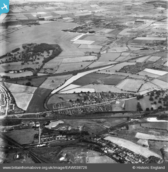
EAW038726 ENGLAND (1951). Nottingham Road and environs near Bulwell Hall Park, Hucknall, 1951. This image has been produced from a print.
© Copyright OpenStreetMap contributors and licensed by the OpenStreetMap Foundation. 2026. Cartography is licensed as CC BY-SA.
Details
| Title | [EAW038726] Nottingham Road and environs near Bulwell Hall Park, Hucknall, 1951. This image has been produced from a print. |
| Reference | EAW038726 |
| Date | 14-August-1951 |
| Link | |
| Place name | HUCKNALL |
| Parish | |
| District | |
| Country | ENGLAND |
| Easting / Northing | 454178, 347373 |
| Longitude / Latitude | -1.1922333589649, 53.020601633481 |
| National Grid Reference | SK542474 |
Pins

Mangan |
Monday 3rd of November 2025 11:54:52 AM | |
|
Mangan |
Wednesday 5th of February 2025 10:59:20 AM | |

Matt Aldred edob.mattaldred.com |
Monday 8th of March 2021 02:24:38 PM | |
|
redmist |
Thursday 23rd of May 2019 05:35:43 PM | |
|
redmist |
Thursday 23rd of May 2019 05:32:34 PM | |
|
redmist |
Thursday 23rd of May 2019 05:31:49 PM | |
|
Adam |
Wednesday 9th of May 2018 12:32:55 PM | |
|
Adam |
Wednesday 9th of May 2018 12:32:13 PM | |
|
Adam |
Wednesday 9th of May 2018 12:30:10 PM | |
|
Adam |
Wednesday 9th of May 2018 12:28:16 PM | |
|
Adam |
Wednesday 9th of May 2018 12:27:48 PM | |
Remember this being the Terminus Garage, where the Nottingham Corporation Trolley Buses swung round and headed back into the city. |
RichieB |
Friday 11th of October 2019 09:00:40 AM |
|
Adam |
Wednesday 9th of May 2018 12:27:09 PM | |
|
sando |
Friday 20th of November 2015 07:46:18 PM | |
|
Dave |
Monday 2nd of February 2015 08:18:07 PM |