
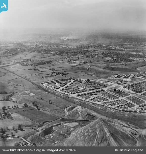
EAW037074 ENGLAND (1951). Chell Heath and environs, Chell Heath, from the north-east, 1951. This image has been produced from a copy-negative.
© Copyright OpenStreetMap contributors and licensed by the OpenStreetMap Foundation. 2026. Cartography is licensed as CC BY-SA.
Details
| Title | [EAW037074] Chell Heath and environs, Chell Heath, from the north-east, 1951. This image has been produced from a copy-negative. |
| Reference | EAW037074 |
| Date | 5-June-1951 |
| Link | |
| Place name | CHELL HEATH |
| Parish | |
| District | |
| Country | ENGLAND |
| Easting / Northing | 388206, 352438 |
| Longitude / Latitude | -2.1760371044141, 53.068749388044 |
| National Grid Reference | SJ882524 |
Pins

bescotbeast |
Monday 20th of November 2023 05:43:27 PM | |
|
bescotbeast |
Monday 20th of November 2023 05:36:23 PM | |
|
bescotbeast |
Monday 20th of November 2023 05:34:12 PM | |
|
bescotbeast |
Monday 20th of November 2023 05:33:06 PM | |
|
bescotbeast |
Monday 20th of November 2023 05:29:20 PM | |
|
bescotbeast |
Monday 20th of November 2023 05:28:10 PM | |
|
bescotbeast |
Monday 20th of November 2023 05:26:04 PM | |
|
bescotbeast |
Monday 14th of March 2022 06:45:34 AM |