
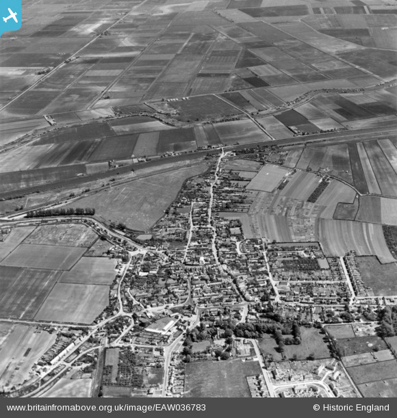
EAW036783 ENGLAND (1951). The town, Littleport, 1951. This image has been produced from a print.
© Copyright OpenStreetMap contributors and licensed by the OpenStreetMap Foundation. 2025. Cartography is licensed as CC BY-SA.
Details
| Title | [EAW036783] The town, Littleport, 1951. This image has been produced from a print. |
| Reference | EAW036783 |
| Date | 5-June-1951 |
| Link | |
| Place name | LITTLEPORT |
| Parish | LITTLEPORT |
| District | |
| Country | ENGLAND |
| Easting / Northing | 557270, 286710 |
| Longitude / Latitude | 0.31481538303932, 52.455294806122 |
| National Grid Reference | TL573867 |
Pins

cptpies |
Friday 20th of May 2016 09:16:26 AM | |
|
cptpies |
Friday 20th of May 2016 09:13:58 AM | |
|
cptpies |
Friday 20th of May 2016 09:13:24 AM | |
|
cptpies |
Friday 20th of May 2016 09:12:43 AM |