
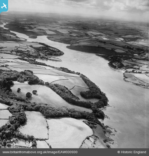
EAW030930 ENGLAND (1950). The Helford River, Bosahan, from the east, 1950
© Copyright OpenStreetMap contributors and licensed by the OpenStreetMap Foundation. 2025. Cartography is licensed as CC BY-SA.
Details
| Title | [EAW030930] The Helford River, Bosahan, from the east, 1950 |
| Reference | EAW030930 |
| Date | 11-July-1950 |
| Link | |
| Place name | BOSAHAN |
| Parish | ST. ANTHONY-IN-MENEAGE |
| District | |
| Country | ENGLAND |
| Easting / Northing | 177109, 26190 |
| Longitude / Latitude | -5.1166926441758, 50.09329520531 |
| National Grid Reference | SW771262 |
Pins

redmist |
Tuesday 22nd of November 2022 11:05:26 PM | |
|
redmist |
Tuesday 22nd of November 2022 07:56:47 PM | |
|
redmist |
Tuesday 22nd of November 2022 07:55:39 PM |