
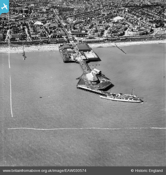
EAW030574 ENGLAND (1950). MV Queen of the Channel at Clacton Pier, Clacton-On-Sea, 1950. This image was marked by Aerofilms Ltd for photo editing.
© Copyright OpenStreetMap contributors and licensed by the OpenStreetMap Foundation. 2026. Cartography is licensed as CC BY-SA.
Nearby Images (48)
EPW049010

EAW030580

EPW046897

EPW039135

EPW039122

EPW018532

EPW039130

EPW039123

EPW042616

EPW039125

EPW039129

EPW041334

EAW048923

EPW039120

EPW049012

EPW041336

EPW039134

EPW039124

EPW041338

EPW039128

EPW049296

EAW030582

EPW041333

EPW042615

EPW041335

EPW001992

EPW042614

EAW030577

EAW030579

EPW039126

EPW039121

EPW058705

EPW058704

EPW039142

EAW030581

EPW039141

EPW039146

EPW041341

EPW039140

EPW039143

EPW041340

EPW041339

EPW039154

EPW039148

EPW039152

EPW039151

EPW039150

EPW058728

Details
| Title | [EAW030574] MV Queen of the Channel at Clacton Pier, Clacton-On-Sea, 1950. This image was marked by Aerofilms Ltd for photo editing. |
| Reference | EAW030574 |
| Date | 28-June-1950 |
| Link | |
| Place name | CLACTON-ON-SEA |
| Parish | |
| District | |
| Country | ENGLAND |
| Easting / Northing | 617846, 214216 |
| Longitude / Latitude | 1.158737697373, 51.783674204877 |
| National Grid Reference | TM178142 |
Pins

Stephen Mirrington |
Wednesday 8th of October 2025 10:31:33 AM | |
|
Stephen Mirrington |
Wednesday 8th of October 2025 10:29:10 AM | |
|
Stephen Mirrington |
Wednesday 8th of October 2025 10:16:52 AM |