
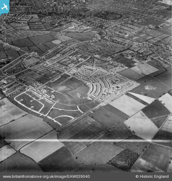
EAW029040 ENGLAND (1950). Construction of the New Nunsthorpe Estate at Sutcliffe Avenue, Nunsthorpe, 1950. This image was marked by Aerofilms Ltd for photo editing.
© Copyright OpenStreetMap contributors and licensed by the OpenStreetMap Foundation. 2026. Cartography is licensed as CC BY-SA.
Details
| Title | [EAW029040] Construction of the New Nunsthorpe Estate at Sutcliffe Avenue, Nunsthorpe, 1950. This image was marked by Aerofilms Ltd for photo editing. |
| Reference | EAW029040 |
| Date | 10-May-1950 |
| Link | |
| Place name | NUNSTHORPE |
| Parish | |
| District | |
| Country | ENGLAND |
| Easting / Northing | 525596, 407182 |
| Longitude / Latitude | -0.10423350954041, 53.545988020841 |
| National Grid Reference | TA256072 |
Pins

stuart |
Wednesday 27th of November 2019 01:56:39 PM | |
|
wadey |
Friday 25th of January 2019 08:24:03 PM | |
|
wadey |
Thursday 20th of November 2014 03:32:10 PM | |
|
wadey |
Thursday 20th of November 2014 03:31:15 PM | |
|
wadey |
Thursday 20th of November 2014 03:30:22 PM | |
|
wadey |
Thursday 20th of November 2014 03:29:24 PM | |
|
wadey |
Thursday 20th of November 2014 03:28:49 PM |