
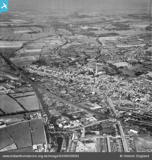
EAW028681 ENGLAND (1950). The town, Grantham, from the south-west, 1950
© Copyright OpenStreetMap contributors and licensed by the OpenStreetMap Foundation. 2026. Cartography is licensed as CC BY-SA.
Details
| Title | [EAW028681] The town, Grantham, from the south-west, 1950 |
| Reference | EAW028681 |
| Date | 19-April-1950 |
| Link | |
| Place name | GRANTHAM |
| Parish | |
| District | |
| Country | ENGLAND |
| Easting / Northing | 491077, 335747 |
| Longitude / Latitude | -0.64549285658553, 52.911102441497 |
| National Grid Reference | SK911357 |
Pins

Matt Aldred edob.mattaldred.com |
Sunday 27th of February 2022 12:59:24 PM | |

mick |
Friday 25th of February 2022 12:49:02 PM | |
|
INR |
Friday 14th of May 2021 01:12:40 PM | |
 |
INR |
Sunday 8th of December 2019 08:07:50 PM |
|
INR |
Sunday 8th of December 2019 08:04:00 PM | |
|
INR |
Sunday 8th of December 2019 07:58:52 PM | |
 |
INR |
Sunday 8th of December 2019 07:56:10 PM |
|
redmist |
Wednesday 22nd of May 2019 07:23:22 PM | |
|
INR |
Tuesday 9th of April 2019 07:32:14 PM | |
|
INR |
Monday 4th of March 2019 07:52:02 PM | |
|
INR |
Monday 4th of March 2019 07:40:23 PM | |
|
Paul |
Friday 26th of January 2018 08:12:30 PM | |
|
Paul |
Friday 26th of January 2018 08:10:48 PM | |
|
Paul |
Friday 26th of January 2018 08:03:46 PM | |
|
MB |
Sunday 23rd of October 2016 10:16:29 AM | |
|
MB |
Sunday 23rd of October 2016 10:12:57 AM | |
Possibly the mill belonging to Henry Bell & Co, founded in 1825, and still going strong today in nearby Dysart Road, making pet foods, etc |
MB |
Sunday 23rd of October 2016 10:15:51 AM |
|
millington |
Friday 17th of July 2015 06:28:35 PM | |

Class31 |
Friday 5th of June 2015 06:39:31 PM | |
 |
Class31 |
Friday 5th of June 2015 06:32:45 PM |
|
Class31 |
Friday 5th of June 2015 06:29:49 PM | |
|
millington |
Friday 5th of June 2015 06:01:32 PM | |
|
millington |
Friday 5th of June 2015 05:59:16 PM | |
|
millington |
Friday 5th of June 2015 05:55:49 PM | |
|
millington |
Saturday 30th of May 2015 12:06:09 AM | |
|
millington |
Saturday 30th of May 2015 12:04:00 AM | |
|
JCC |
Friday 28th of February 2014 10:39:18 PM | |
|
JCC |
Friday 28th of February 2014 10:38:47 PM | |
|
JCC |
Friday 28th of February 2014 10:38:17 PM | |
|
JCC |
Friday 28th of February 2014 10:36:27 PM |


