
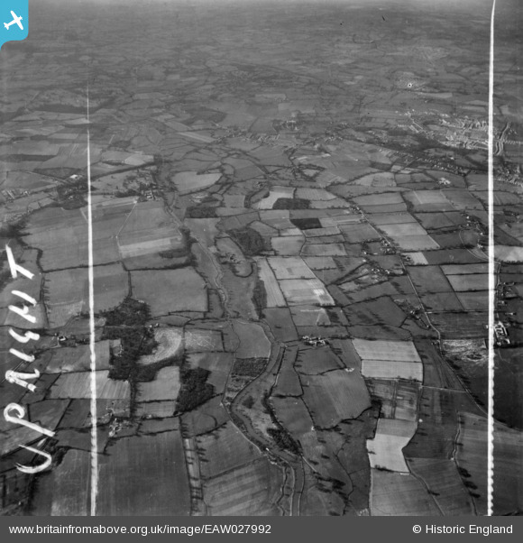
EAW027992 ENGLAND (1950). The River Lodden and surrounding countryside, Lower Earley, from the north-east, 1950. This image has been produced from a print marked by Aerofilms Ltd for photo editing.
© Copyright OpenStreetMap contributors and licensed by the OpenStreetMap Foundation. 2026. Cartography is licensed as CC BY-SA.
Details
| Title | [EAW027992] The River Lodden and surrounding countryside, Lower Earley, from the north-east, 1950. This image has been produced from a print marked by Aerofilms Ltd for photo editing. |
| Reference | EAW027992 |
| Date | 17-February-1950 |
| Link | |
| Place name | LOWER EARLEY |
| Parish | EARLEY |
| District | |
| Country | ENGLAND |
| Easting / Northing | 476177, 169845 |
| Longitude / Latitude | -0.90429939468146, 51.421998755273 |
| National Grid Reference | SU762698 |
Pins
 Now called Shinfield Green. Site of the new Aldi store. (Or is it Lidl?) Now called Shinfield Green. Site of the new Aldi store. (Or is it Lidl?) |

designking |
Saturday 8th of August 2026 09:55:06 PM |
| Now called Shinfield Green. Site of the new Aldi store. |
designking |
Saturday 8th of August 2026 09:52:19 PM |
| All this site now to be the new film studios and the Natural History Museum store |
designking |
Saturday 8th of August 2026 09:49:32 PM |
| Cutbush Lane |
designking |
Saturday 8th of August 2026 09:47:17 PM |
| Beech Lane |
designking |
Saturday 8th of August 2026 09:42:39 PM |
| Woodbine Cottages Lower Earley. Now Woodbine Close. |
designking |
Saturday 8th of August 2026 09:41:16 PM |
| River Lodden |
designking |
Saturday 8th of August 2026 09:37:49 PM |
| Black Boy Public House |
bumpff |
Monday 21st of December 2015 07:17:33 AM |
| Shinfield Road A327 |
bumpff |
Monday 21st of December 2015 06:58:28 AM |
| Hillside Farm |
bumpff |
Monday 21st of December 2015 06:56:35 AM |
| Coppice Farm |
bumpff |
Monday 21st of December 2015 06:55:32 AM |
| Ruined church at Arborfield |
designking |
Friday 28th of August 2015 10:44:35 PM |
| Holly Cottage & Planters Lodge |
designking |
Thursday 30th of October 2014 08:05:35 PM |
| Cutbush Lane |
designking |
Tuesday 28th of October 2014 08:11:57 PM |
| (Now) Carshalton Way |
designking |
Tuesday 28th of October 2014 08:11:16 PM |
| Elm Lane, Lower Earley |
designking |
Tuesday 28th of October 2014 08:10:22 PM |