
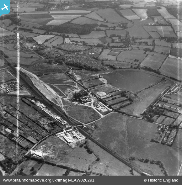
EAW026291 ENGLAND (1949). Rye House Power Station under construction and the surrounding area, Rye Park, 1949. This image has been produced from a print marked by Aerofilms Ltd for photo editing.
© Copyright OpenStreetMap contributors and licensed by the OpenStreetMap Foundation. 2025. Cartography is licensed as CC BY-SA.
Nearby Images (48)
EAW026274

EAW040615

EAW027795

EAW032357

EAW034502

EAW040607

EAW034496

EAW036394

EAW022414

EAW042020

EAW040616

EAW026275

EAW047235

EAW027797

EAW034500

EAW028689

EAW053094

EAW022411

EAW047246

EAW034498

EAW040610

EAW047236

EAW026282

EAW040609

EAW040614

EAW032354

EAW032360

EAW036382

EAW040604

EAW036379

EAW050614

EAW053095

EAW040618

EAW042018

EAW042025

EAW032359

EAW040605

EAW027802

EAW040606

EAW032358

EAW036395

EAW032361

EAW036381

EAW028700

EAW053076

EAW027801

EAW026286

EAW034501

Details
| Title | [EAW026291] Rye House Power Station under construction and the surrounding area, Rye Park, 1949. This image has been produced from a print marked by Aerofilms Ltd for photo editing. |
| Reference | EAW026291 |
| Date | 19-August-1949 |
| Link | |
| Place name | RYE PARK |
| Parish | |
| District | |
| Country | ENGLAND |
| Easting / Northing | 538714, 208817 |
| Longitude / Latitude | 0.010156907916901, 51.760380764538 |
| National Grid Reference | TL387088 |
Pins
Be the first to add a comment to this image!