
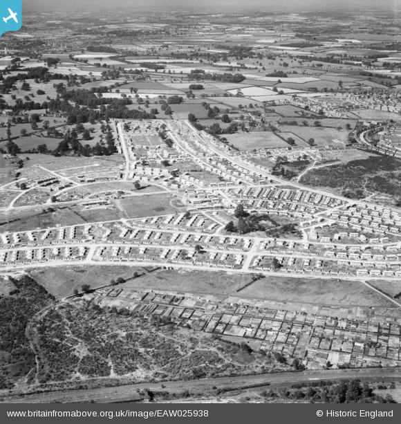
EAW025938 ENGLAND (1949). Housing estate under construction at Bilborough, Nottingham, 1949
© Copyright OpenStreetMap contributors and licensed by the OpenStreetMap Foundation. 2026. Cartography is licensed as CC BY-SA.
Details
| Title | [EAW025938] Housing estate under construction at Bilborough, Nottingham, 1949 |
| Reference | EAW025938 |
| Date | 15-August-1949 |
| Link | |
| Place name | NOTTINGHAM |
| Parish | |
| District | |
| Country | ENGLAND |
| Easting / Northing | 452090, 341096 |
| Longitude / Latitude | -1.224372862478, 52.964382481574 |
| National Grid Reference | SK521411 |
Pins

martynrb |
Thursday 26th of October 2023 12:46:54 PM | |
|
Rob |
Monday 5th of September 2022 11:20:20 PM | |
|
Rob |
Monday 5th of September 2022 11:16:45 PM | |
|
Yargneb |
Monday 18th of November 2019 03:40:34 PM | |
|
Maitland |
Thursday 3rd of August 2017 10:36:22 AM | |
|
Maitland |
Thursday 3rd of August 2017 10:27:43 AM | |
|
Maitland |
Thursday 3rd of August 2017 10:26:02 AM | |
Looks to run from here through the development to "Old Coach Road" which runs almost to Wollaton Hall. Faint traces can be seen across the development in this image. |
Yargneb |
Monday 18th of November 2019 03:44:12 PM |
|
Maitland |
Thursday 3rd of August 2017 10:17:51 AM | |
|
Maitland |
Thursday 3rd of August 2017 10:12:19 AM | |
|
Maitland |
Thursday 3rd of August 2017 10:08:02 AM |