
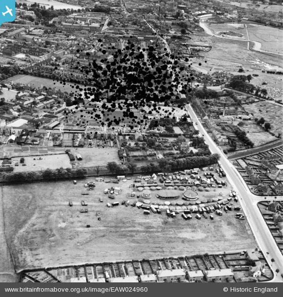
EAW024960 ENGLAND (1949). A fairground on Stone Flats, Stafford, 1949. This image has been produced from a damaged negative.
© Copyright OpenStreetMap contributors and licensed by the OpenStreetMap Foundation. 2026. Cartography is licensed as CC BY-SA.
Details
| Title | [EAW024960] A fairground on Stone Flats, Stafford, 1949. This image has been produced from a damaged negative. |
| Reference | EAW024960 |
| Date | 21-July-1949 |
| Link | |
| Place name | STAFFORD |
| Parish | |
| District | |
| Country | ENGLAND |
| Easting / Northing | 391799, 324566 |
| Longitude / Latitude | -2.1217029870558, 52.818239475025 |
| National Grid Reference | SJ918246 |
Pins

Triggy |
Friday 6th of June 2014 10:50:12 PM | |
|
Fonzie-NL |
Wednesday 19th of February 2014 11:53:03 AM | |
|
Fonzie-NL |
Wednesday 19th of February 2014 11:50:46 AM | |
|
Fonzie-NL |
Wednesday 19th of February 2014 11:47:35 AM | |
|
Fonzie-NL |
Wednesday 19th of February 2014 11:46:59 AM | |
|
Fonzie-NL |
Wednesday 19th of February 2014 11:45:29 AM |