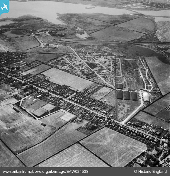
EAW024538 ENGLAND (1949). The site of the Cannock Chase Collieries and the High Street, Chasetown, 1949
© Copyright OpenStreetMap contributors and licensed by the OpenStreetMap Foundation. 2025. Cartography is licensed as CC BY-SA.
Details
| Title | [EAW024538] The site of the Cannock Chase Collieries and the High Street, Chasetown, 1949 |
| Reference | EAW024538 |
| Date | 8-July-1949 |
| Link | |
| Place name | CHASETOWN |
| Parish | BURNTWOOD |
| District | |
| Country | ENGLAND |
| Easting / Northing | 404384, 308836 |
| Longitude / Latitude | -1.9351516046237, 52.676861979185 |
| National Grid Reference | SK044088 |
Pins

areed |
Thursday 23rd of April 2020 08:43:11 PM | |

areed |
Thursday 23rd of April 2020 08:42:02 PM | |

areed |
Thursday 23rd of April 2020 08:39:10 PM | |

areed |
Thursday 23rd of April 2020 08:36:50 PM | |

Class31 |
Sunday 31st of August 2014 07:46:20 PM | |

KevTheBusDriver |
Sunday 2nd of February 2014 06:45:01 PM | |

KevTheBusDriver |
Sunday 2nd of February 2014 06:43:47 PM |

