
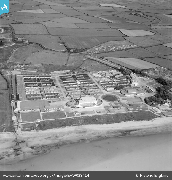
EAW023414 ENGLAND (1949). Middleton Tower Holiday Camp, Middleton, 1949
© Copyright OpenStreetMap contributors and licensed by the OpenStreetMap Foundation. 2026. Cartography is licensed as CC BY-SA.
Details
| Title | [EAW023414] Middleton Tower Holiday Camp, Middleton, 1949 |
| Reference | EAW023414 |
| Date | 25-May-1949 |
| Link | |
| Place name | MIDDLETON |
| Parish | MIDDLETON |
| District | |
| Country | ENGLAND |
| Easting / Northing | 341216, 458277 |
| Longitude / Latitude | -2.8972499497741, 54.01696019437 |
| National Grid Reference | SD412583 |
Pins

redmist |
Sunday 27th of August 2023 10:37:38 PM | |

Matt Aldred edob.mattaldred.com |
Thursday 19th of May 2022 01:54:22 PM | |

Sparky |
Monday 28th of August 2017 01:59:06 PM |